Yosemite National Park
Abraham Lincoln first protected Yosemite in his Yosemite Grant of 1864 which declared Yosemite as federally preserved land. With 1,180 square miles of land, Yosemite is the 8th most-visited National Park in the United States with over 4 million visitors every year.
about the sites:
Site 1: Yosemite Valley N 37° 43' 24.70" W 119° 37' 18.29"
Yosemite National Park, although 95% is designated "wilderness" is quite developed in that remaining 5%. The Yosemite Valley is quite similar to Zion, in that there's a WHOLE LOT of infrastructure in the middle of the most popular valley. For this reason, the area where I took the El Capitan and 3 Brothers gifs are bordering on a Bortle class 3. The photo I *wanted* to get of 3 Brothers requires actually getting yourself, your camera, and a tripod INTO the Merced River. So I will have to invest in some waders and return to Yosemite National Park for THAT shot!
According to www.LightPollutionMap.info, the Welcome Sign is a Bortle Class 2 location.
Site 2: Olmsted Point N 37° 48' 38.50" W 119° 29' 06.27"
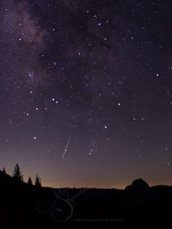
Olmsted Point (Alt 8,300 ft) is a viewing area off Tioga Pass Road in Yosemite National Park which offers a view south into Tenaya Canyon. In the distance, you can see the Northern face of Half Dome.
According to www.LightPollutionMap.info, this is a Bortle Class 2 location.
Site 3: Tenaya Lake N 37° 50' 01.60" W 119° 27' 32.75"
So I totally lucked out on this site for a couple of reasons. Tioga Road (Highway 120) is under construction for miles on either side of this spot. As it skirts around Tenaya Lake, it is scraped down to its dirt base. Because of its remote location, one can see the headlights of oncoming cars well in advance of their arrival. This allowed me to take 12 uninterrupted 15-second exposures that I then combined into one large panorama using the PTGui program. The fact I came across this particular vantage point at *exactly* the right time to see the Milky Way soaring up from the valley beyond was only because I had wrapped up my viewing from Olmsted Point and was heading out of the park.
According to www.LightPollutionMap.info, the Tenaya Lake is a Bortle Class 2 location due to light from Los Angeles in the south.
Site 4: Tioga Pass Overlook 37°56'29.69"N 119°13'46.19"W
One of the things I love about living out here in the West, you can be on your way to ONE place, but find a nice little turn out and decide to photograph THERE instead. Towards the East entrance of Yosemite, coming from the Mono Lake area, this overlook looks east down the Lee Vining creek valley towards Mono Lake. A Waterfall cascading from Ellery Lake is a perfect welcome to Yosemite - which is known for its waterfalls. The 180-degree panorama shows the Planetary Parade that took place in early- to mid-2022. From Left to Right, Venus, Uranus, Mars, Jupiter, Neptune, and Saturn are in a nice line. The only missed planet is Mercury (which was too close to the Sun on this day to see).
According to www.LightPollutionMap.info, this area is a Bortle Class 2 location.


